CEDRA-SectorPolygonsTM
Create Polygons representing Sectors Emanating from a Point
CEDRA SectorPolygonsTM is an ArcView® GIS and ArcGIS® extension, that is included with all of the CEDRA AVseriesTM software, that enables the user to create polygons which represent sectors of concentric circles. This functionality is useful when the user is interested in determining areas that emanate radially from a base point. For example, assume that there is a hazardous waste spill where a harmful gas has been released. Based upon weather conditions at the time, the effect of the gas dissipates over a physical distance. Using CEDRA SectorPolygonsTM the user can create polygons that represent the effect of the dissipation. These polygons can then be superimposed upon a base map at which point various types of spatial analysis techniques can be used to identify those locations that would be impacted the most.
 |
CEDRA-SectorPolygonsTM
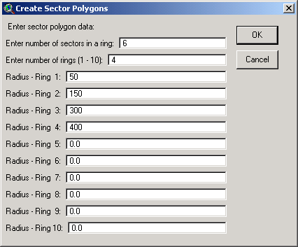
CEDRA-SectorPolygonsTM allows
the user to create polygons that represent
the sectors of concentric circles. As seen above, the user
is asked to specify the number of sectors and rings. Sectors are
similar to the number of slices in a pie, where the pie represents
a circle. If the number of sectors is one (1), the command will
generate one polygon for the ring.
Rings, on the other hand, represent the concentric circles or,
as they are sometimes referred to as, buffer rings. Each buffer
ring is defined by a radius with each ring sharing the same center.
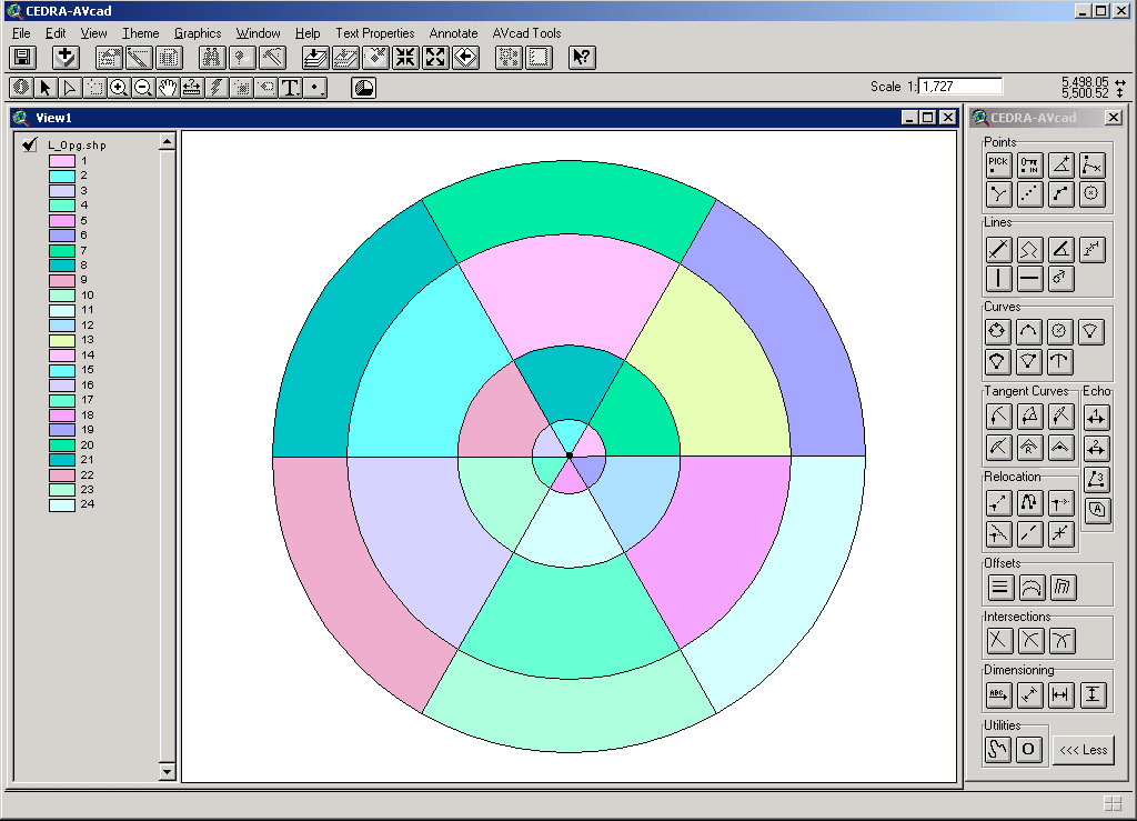
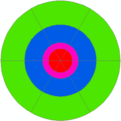
As shown below four rings have been generated with each ring containing
six sectors.
 |
CEDRA-SectorPolygonsTM will
create individual polygons, using the data specified by the user,
and for each polygon assign a unique identification number (the
CNT attribute). Furthermore, stored as additional attributes for
each polygon will be: (a) the ring number that the polygon is
associated with (the RING attribute), (b) the radius of the ring
(RADIUS) in world units such as feet or meters, (c) the area of
the polygon in square feet/square meters (ARA), (d) the area of
the polygon in acres/hectares (SQR_ARA) and (e) the perimeter
of the polygon in feet/meters (LEN). Using these attributes, the
user can display the polygons in a variety of different manners.
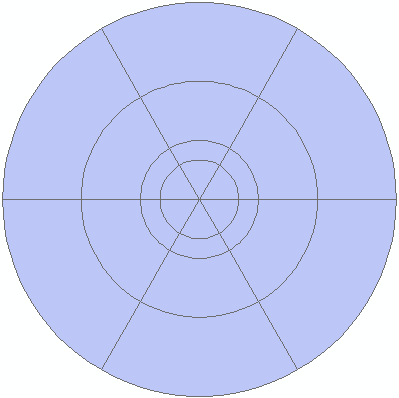
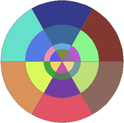
Shown below are three different classifications, one with no classification,
one based upon the CNT attribute and the other on the RING attribute.
When the theme or layer containing the newly generated polygons
has no classification assigned to it, all polygons in the theme
or layer will have the same color. When the theme or layer is
classified based upon the unique values of the CNT attribute each
polygon in the theme or layer will appear in a different color,
while the RING classification shows each polygon within a ring
in the same color with each ring displayed in a different color.
|
|
CNT Attribute |
RING Attribute |
 |
 |
 |